

"What Our Gearhead® Experts Are Saying:""I love how effortless the Yuba Trail One-Piece makes getting outside. It’s supportive, breathable, and dries fast—perfect for hitting the trail, hopping in a lake, and then lounging in the sun. The built-in...
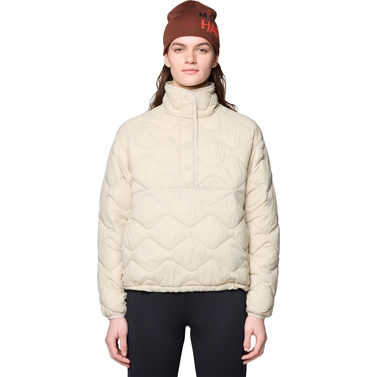
"What Our Gearhead® Experts Are Saying: ""This pullover nails the vibe—super soft, lightweight, and just enough insulation for cool weather. I’ve been tossing it over tees for camp mornings or layering it under a shell when storms roll in. The snap...
))/2131442.json)
Boots made to handle the rigors of mountainous terrain, Kenetrek Mountain Extreme 400 Hunting Boots for Men deliver superior support from aightweight and comfortable boot. Extremely popular among outdoorsmen in the western US, the Mountain Extreme
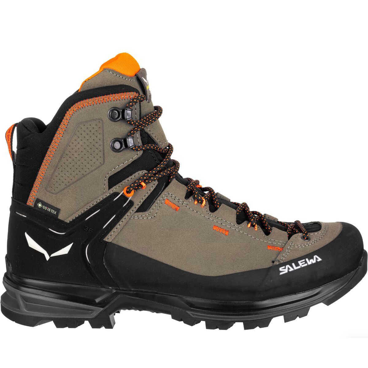
The Mountain Trainer 2 Mid GTX Backpacking Boot brings all of the features we loved from the first generation boot, in a 15% lighter package to solidify this boot in the ultralight backpacking category. The GORE-TEX waterproof lining gives us confidence...
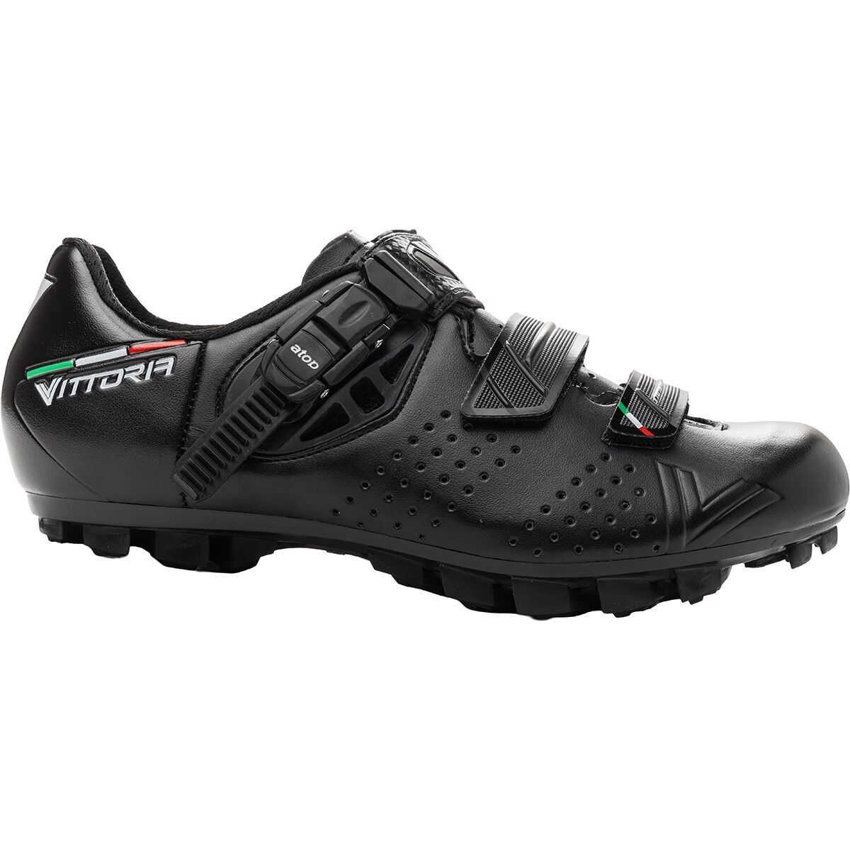
"What Our Gearhead® Experts Are Saying:""The Hera feels like a shoe I can wear day after day without thinking about it. The buckle and strap system is simple but super secure, and the nylon sole gives just enough stiffness for efficient pedaling while...
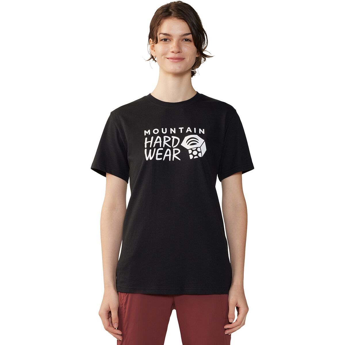
The Mountain Hardwear MHW Logo Short-Sleeve T-Shirt is a casual and classic t-shirt designed for outdoor adventures big and small.
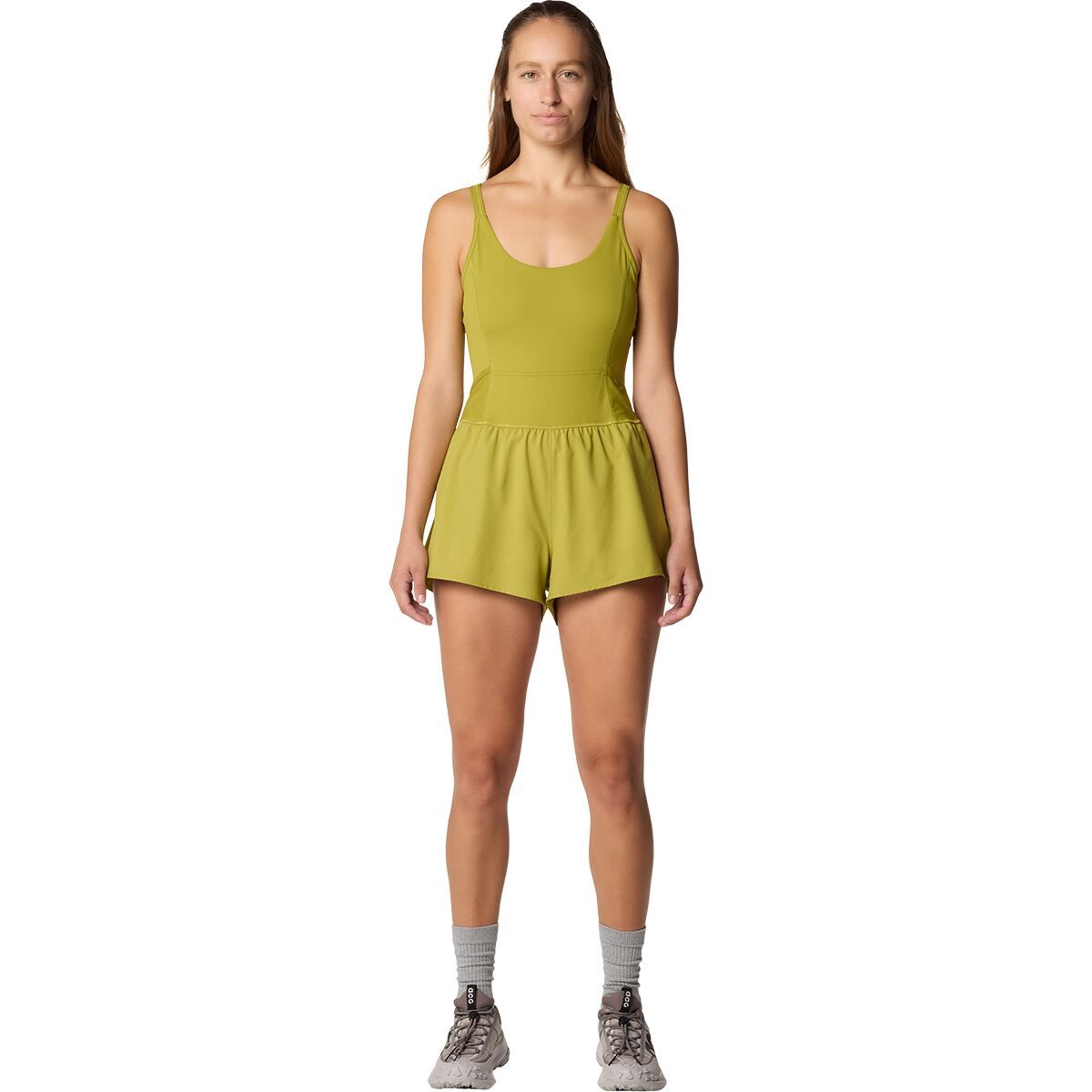
"What Our Gearhead® Experts Are Saying:""I love how effortless the Yuba Trail One-Piece makes getting outside. It’s supportive, breathable, and dries fast—perfect for hitting the trail, hopping in a lake, and then lounging in the sun. The built-in...
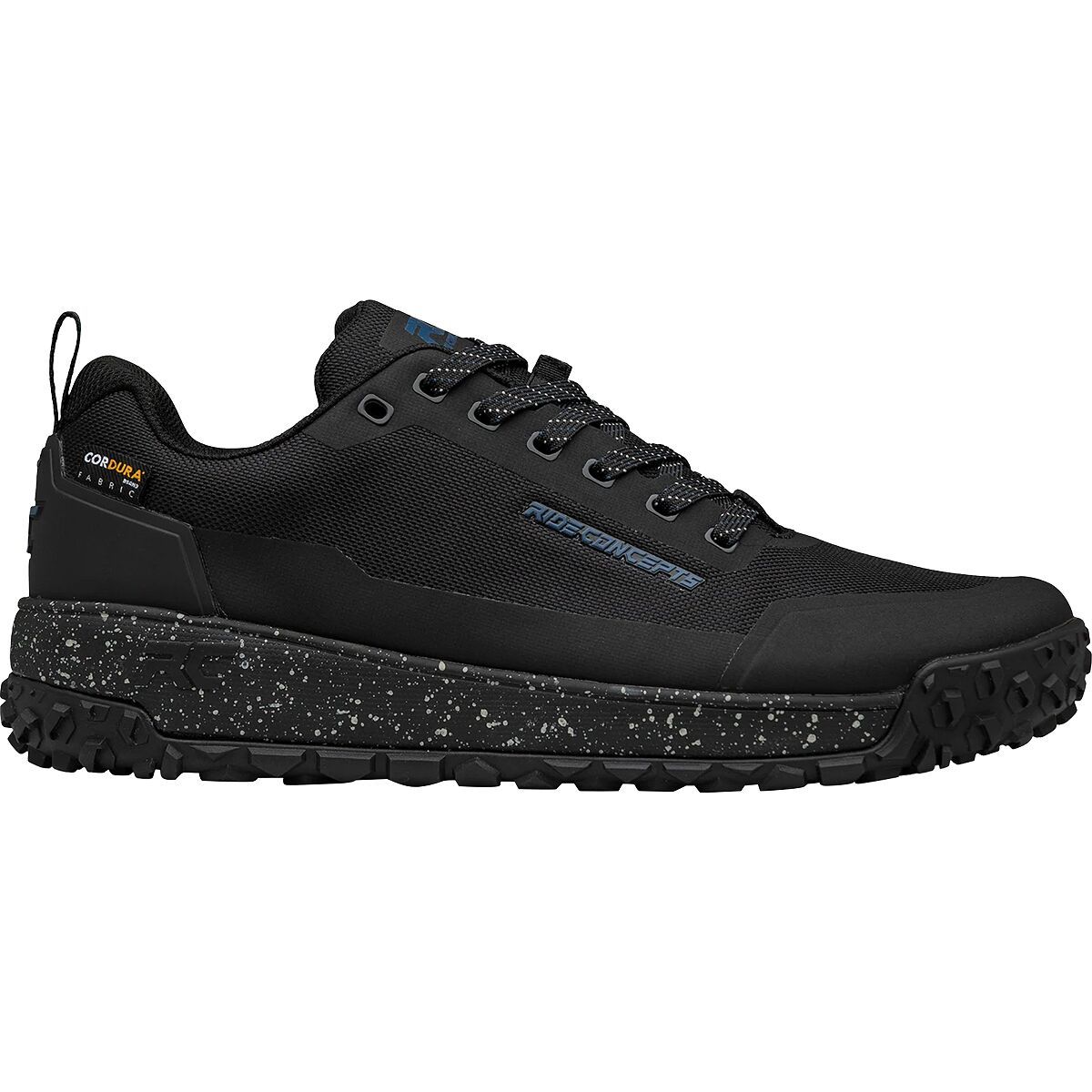
When we're snaking through turns and airing over jumps we're glad we have the Ride Concepts Tallac to keep our feet firmly planted on the pedals. These high-performance flat pedal shoes are constructed with a durable Cordura upper, as well as a tacky...
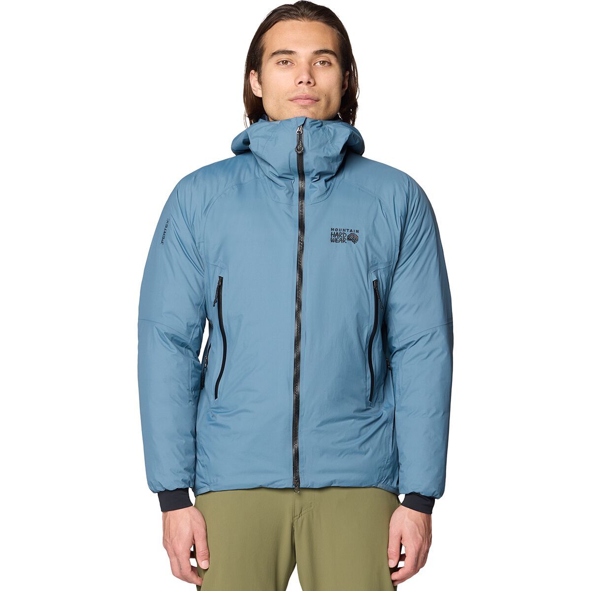
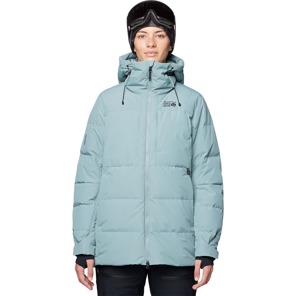
When battling challenging terrain and cruel conditions, we stay warm, dry, and light in the Mountain Hardwear Storm Whisperer Insulated Jacket. The featherweight build features rugged ripstop fabric and lofty down insulation to shrug off sharp rock and...
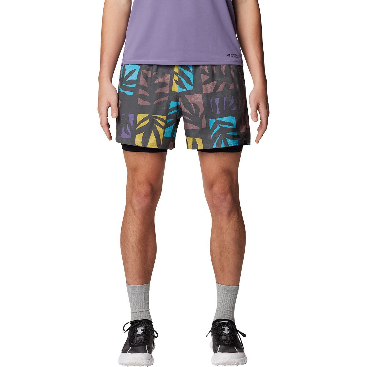
"What Our Gearhead® Experts Are Saying:""These are my go-to lightweight shorts for hot days and active adventures. The stretch-woven fabric feels weightless, and the built-in mesh brief adds next-level comfort and breathability. Whether I’m running...
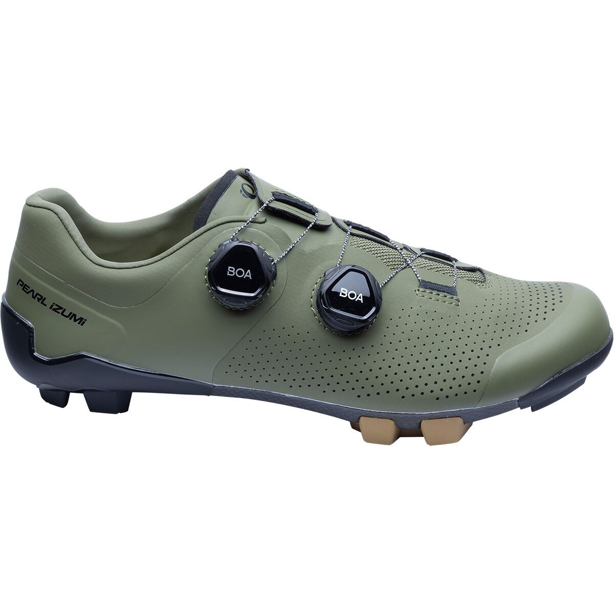
The Expedition Pro Mountain Bike Shoe combines the stiffness of a road shoe with the superior durability of a mountain bike shoe, making it an ideal choice for any mountain, gravel, or cross-country adventure. Its perforated synthetic leather upper material...
"What Our Gearhead® Experts Are Saying:""This jacket is a staple for every season—super soft fleece, lightweight enough for layering, and tough enough for playground roughhousing. My kids reach for it every day and it washes up good as new even after...
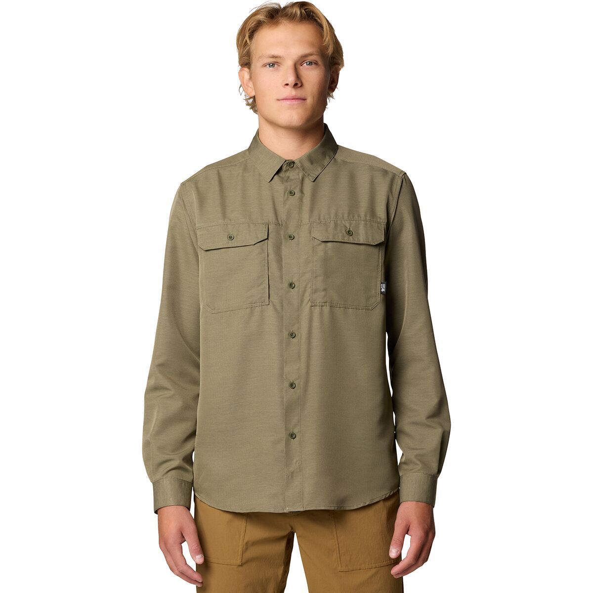
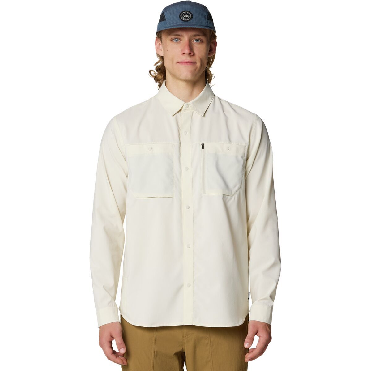
When we are headed for the hills for an adventure we button-up the Mountain Hardwear Canyon Long-Sleeve Shirt. This stylish shirt combines UPF 50 protection with vents on the back and chest with moisture wicking polyester fabric to keep us feeling fresh...
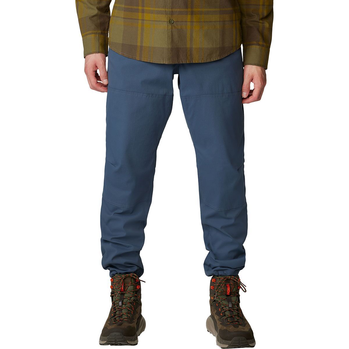
Mountain Hardwear's AP Active Crossover Pant is crafted with a durable nylon weave to accommodate all our adventures. These all-purpose pants feature the stretch, strength, and articulated shape necessary for scrambling up sketchy trails, dominating difficult...
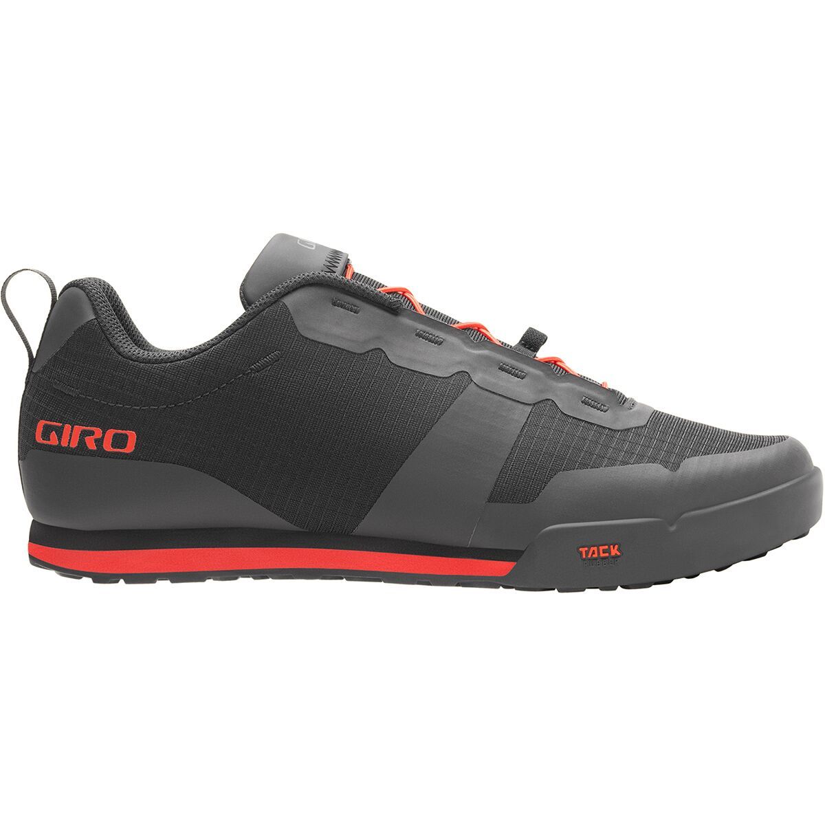
Wherever the trail takes we know our feet will be happy and securely stuck to the pedals in the Giro Tracker Fastlace. These flat pedal mountain bike shoes are made of a durable synthetic upper with polyurethane overlays for abrasion resistance. The Fastlace...
))/3419145.json)
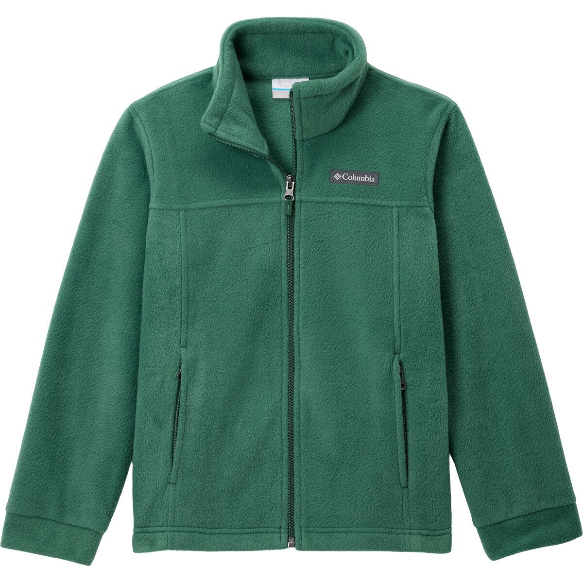
The Columbia Steens Mountain™ Full-Zip Fleece 2.0 Jacket for Men is the second generation of a classic. This Columbia jacket features a full-zip front, zip-close hand pockets to secure essentials, a stand-up collar, and elastic cuffs. T

"What Our Gearhead® Experts Are Saying:""The MX239 Wide is a dream come true for riders who need extra space in their mountain bike shoes. It offers the same high-performance features as the standard MX239, with a premium leather upper that molds to...
"What Our Gearhead® Experts Are Saying:""This jacket is my secret weapon for staying warm on sub-zero lift days. The 650-fill down keeps the chill out without making me feel like a marshmallow, and the relaxed fit still leaves room for layering. Plus,...
))/4078620.json)
Celebrate nature and stay comfortable with the Ascend Organic Mountain Texture Graphic Short-Sleeve T-Shirt foradies. This soft,ight, and comfortable T-shirt is made with 100% organic cotton. The front features an artistic screen-printed
Performance never looked so dapper before the Mountain Hardwear Trail Sender Long-Sleeve Shirt. The recycled ripstop material not only lowers our environmental impact, but it also fights off branches, stretches with our every move, wicks away our beading...
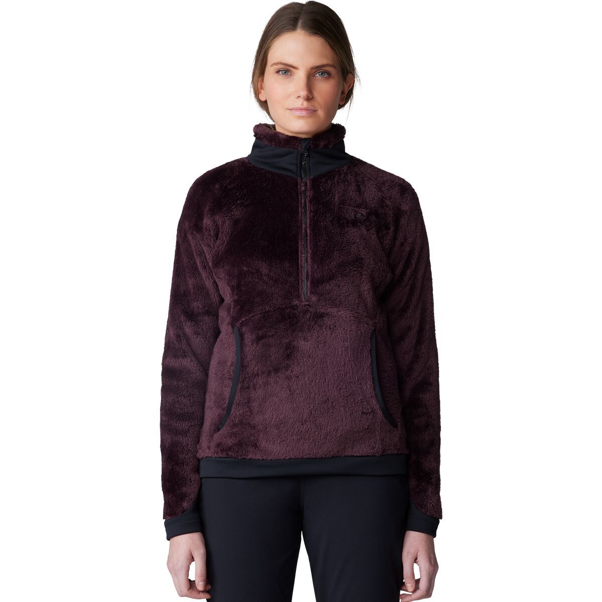
From staying warm on the trail to casual at-home comfort, the Mountain Hardwear Polartec High Loft Pullover is our go-to on a chilly fall day. The Polartec High Loft fleece construction keeps us warm and sits comfortably against the skin, and the integrated...
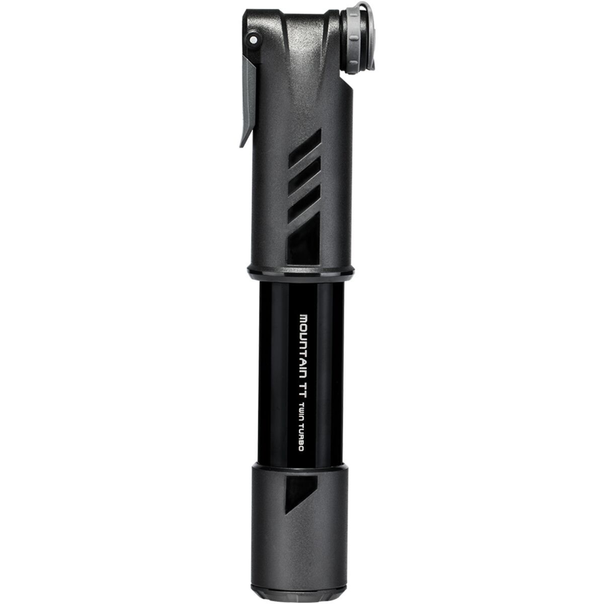
Upon first glance, you'd think the Topeak Mountain TT Twin Turbo Mini Pump would lack serious power, seeing its ultra-compact size. However, you'd be wrong to make this assumption, as this pump features Twin Turbo Technology, which compresses a large...

"What Our Gearhead® Experts Are Saying:""The Hera feels like a shoe I can wear day after day without thinking about it. The buckle and strap system is simple but super secure, and the nylon sole gives just enough stiffness for efficient pedaling while...
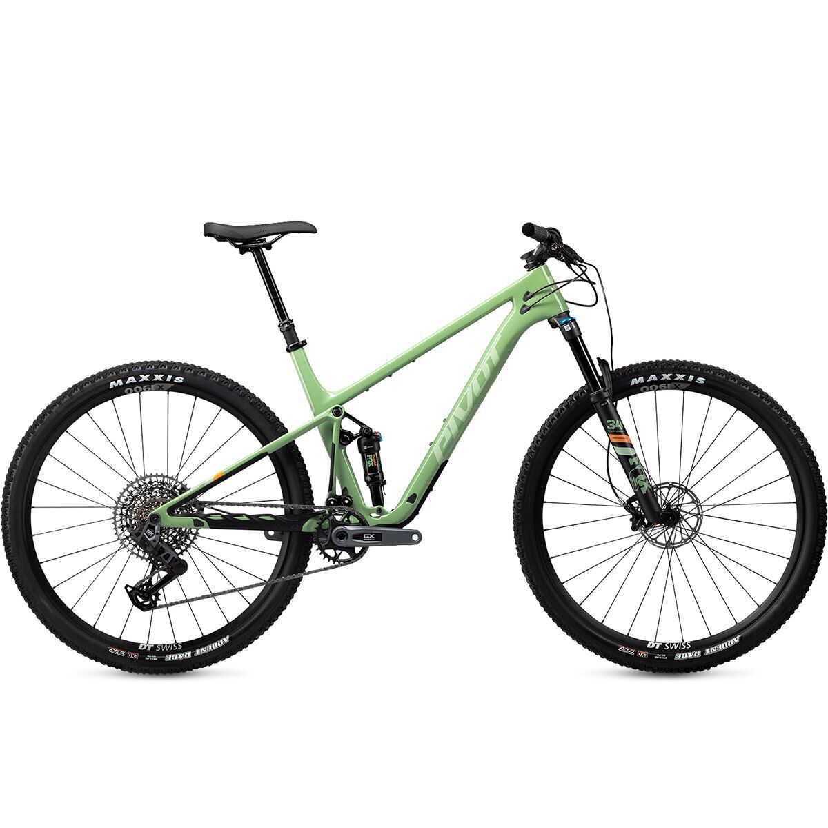
Cross-country bike in efficiency and lightweight trail bike in capability, the Pivot Mach 4 SL is a versatile bike that blurs the lines on what a cross-country bike can do. The newest version of the Mach 4 SL has been redesigned and features a slackened...
Pumpkin lattes and golden leaf-laden trails let us know that it's time to zip into the Mountain Hardwear Oakoram Fleece Full-Zip Jacket. The soft, recycled microfleece provides plenty of warmth for our walks to the coffee shop and our autumnal hikes.