

The Garmin Rino 750 is a 5W FRS/GMRS two-way radio that allows us to communicate with fellow Rino 750 users by voice or text message when windy conditions or noise-sensitive endeavors arise when we're hunting, hiking, or trail running. We appreciate that the three-inch screen is easy to read in bright sunlight, and features a touchscreen that can be used with a gloved or non-gloved hand. It also has high-sensitivity GPS and GLONASS satellite reception that provides better tracking in tough, varied terrain than GPS alone. Unique to this series is the Position Reporting, which allows you to send your exact location to other Rino users. To achieve such a specific location, the Rino relies on the GPS and GLONASS receiver, as well as a quad helix antenna to identify location. The barometric altimeter and three-axis compass help maintain bearings without having to keep the unit totally steady or level. A worldwide shaded-relief basemap lets you see your surroundings, while the active weather portion of the Rino forecasts and tracks weather in real-time, giving you the edge you need when you're out in the backcountry--simply pair the Rino with a compatible smartphone and the Garmin connect app for real-time alerts, coverage, and conditions.
Price: $549.99 from Backcountry
| Merchant | Price | |
|---|---|---|
| $549.99 | Visit Store |

The Garmin Rino 750 is a 5W FRS/GMRS two-way radio that allows us to communicate with fellow Rino 750 users by voice or text message when windy conditions or noise-sensitive endeavors arise when we're hunting, hiking, or trail running. We appreciate that...

With wireless connectivity, multi-GNSS support, and 168 hours of battery life, the Garmin eTrex SE is our trusted companion while hiking and backpacking. This handheld GPS is easy to use and pairs with the Garmin Explore app to plan trips, check the weather,...
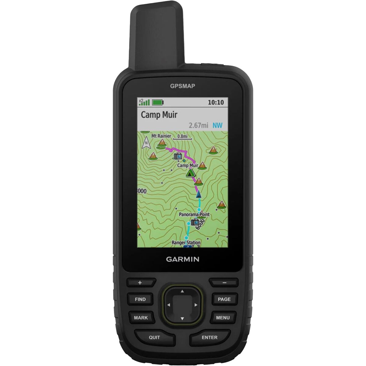
Preparation and knowledge are paramount in the backcountry and we use the Garmin GPSMAP 67 to assist in both of those departments. This handheld GPS tool can access multiple global navigation satellites to help us stay on track, offers topographic maps...